 geocatalogue.geoportail.lu
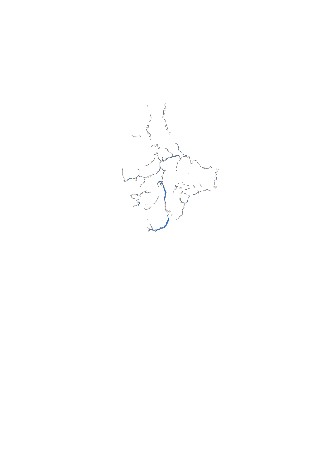
Floodplain 1993 flood event (without Mosel)
Layer showing the floodplain of the Alzette and lower Sûre river during the 1993 flood event (Data based on photographs taken out of an airplaine, topographic map 1/10.000 and field surveys)
Simple
- Date (Creation)
- 1993-12-31T00:00:00
- Citation identifier
- / 78c692f3-ad20-467b-b03a-0d020a821647
- Presentation form
- Digital map
- Status
- Completed
- Point of contact
-
Organisation name Individual name Electronic mail address Role Administration de la gestion de l'eau
Division de l'hydrologie
Point of contact
- Maintenance and update frequency
- As needed
-
Entités au Grand-Duché de Luxembourg
-
-
Grand-Duché du Luxembourg
-
- Keywords
-
- Keywords
-
-
floodplain
-
Alzette
-
lower Sûre
-
1993
-
flood
-
inondation
-
geoportail.lu
-
-
geoportail.lu themes
-
-
Lintgen
-
Water
-
Lenoz
-
Main
-
-
geoportail.lu structure
-
-
Lintgen>Water data
-
Water>Floods directive [FD]>Historic floodplains
-
Lenoz>Floods directive [FD]>Historic floodplains
-
Main>Environment, Biology and Geology>Floods directive [FD]>Historic floodplains
-
- Use constraints
- Other restrictions
- Other constraints
-
Creative Commons 1.0 Universal (CC0 1.0) Public Domain Dedication
- Spatial representation type
- Vector
- Denominator
- 0
- Language
- Français
- Character set
- UTF8
- Topic category
-
- Environment
- Inland waters
- Geoscientific information
))
- Reference system identifier
- EPSG / http://www.opengis.net/def/crs/EPSG/0/2169
- Distribution format
-
Name Version DXF
TIFF
SHAPE
PDF
- OnLine resource
-
Protocol Linkage Name OGC:WMS-1.3.0-http-get-map
https://wms.geoportail.lu/public_map_layers/service 641
WWW:LINK-1.0-http--link
https://data.public.lu/fr/datasets/floodplain-1993-flood-event-without-mosel/ OGC API-Features
https://features.geoportail.lu/collections/641 OGC API - Features
- OnLine resource
-
Protocol Linkage Name https://map.geoportail.lu/theme/main?version=3&zoom=8&X=667917&Y=6394482&lang=fr&layers=641&opacities=1 Floodplain 1993 [without Mosel]
Metadata
- File identifier
- 78c692f3-ad20-467b-b03a-0d020a821647 XML
- Metadata language
- Français
- Character set
- UTF8
- Hierarchy level
- Dataset
- Hierarchy level name
-
dataset
- Date stamp
- 2025-12-03T11:27:37.763907Z
- Metadata standard name
-
ISO 19115:2003/19139
- Metadata standard version
-
1.0
- Metadata author
-
Organisation name Individual name Electronic mail address Role Administration de la gestion de l'eau
Division de l'hydrologie
Point of contact
- Other language
-
Language Character encoding Luxembourgish; Letzeburgesch UTF8 English UTF8 German UTF8 French UTF8
)))