 geocatalogue.geoportail.lu
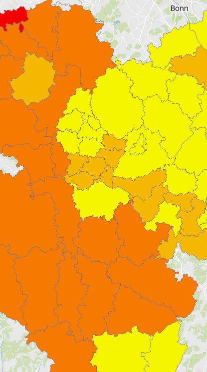
AgriPV economic potential at the level of Kreise arrondissements and cantons
Economic potential for integrated photovoltaics on agricultural lands at the level of Kreise, arrondissements and cantons
- Geodata sources (administrative entities): ACT Luxembourg 2017, IGN France 2017, GeoBasis-DE / BKG 2017, NGI-Belgium 2017. Harmonization: SIG-GR / GIS-GR 2020
- Thematic data sources: © Ministerium für Wirtschaft, Verkehr, Landwirtschaft und Weinbau (MWVLW) Rheinland-Pfalz 2021; Ministerium für Umwelt und Verbraucherschutz (MUV) Saarland 2020; ASTA Luxembourg 2021 ; IGN France – 2020; SPW Wallonie 2020. Harmonization: © IZES gGmbH 2022
- Territorial entities: Kreise (Saarland), Arrondissements (Wallonia and Lorraine), cantons (Luxembourg)
- The map shows the economic potential for integrated photovoltaics on agricultural lands by using vertical bifacial PV systems in the Greater Region. Only the prioritised areas with an area size (≥ 10 ha) and crops without maize are shown. With the current technology used, areas of 10 ha or more can be used for AgriPV in an economically viable way. Areas cultivated with maize are unsuitable due to the growth height of the maize plants. Depending on the current legal framework, the areas are shown in colour. When a coloured area is selected, further information on the potential output and electricity generation as well as on the reference to the legal framework conditions is displayed. This is a theoretical potential based on the calculations and the assumptions on which the calculations are based. Therefore, when using the data, it should be noted that the data are based on a statistical approach and represent an approximation or an estimate regarding the potential.
- The Luxembourg Ministry of Energy and Spatial Planning has organised a call for tenders in October 2022 to promote Agri-PV pilot installations on agricultural land. The PV projects are intended to ensure continued agricultural production on the land while promoting biodiversity (flora). The projects will be supported through a market premium over a period of 15 years. It should be noted that the areas prioritised on the greater-regional maps and the potentials identified are based on project-specific assumptions within the framework of the "PV follows function" project and do not allow a statement to be made on either the approvability or the technical-economic feasibility of a project within the framework of the Luxembourg Ministry's call for tenders.
Simple
- Date (Revision)
- 2022-11-15T00:00:00
- Citation identifier
- / 5c6b8af5-947a-4599-93e9-872afcd7eb2d
- Presentation form
- Digital map
- Status
- Completed
- Point of contact
-
Organisation name Individual name Electronic mail address Role SIG-GR - Ministère de l'Energie et de l'Aménagement du territoire - Département de l'aménagement du territoire
Thierry Hengen
Author
- Maintenance and update frequency
- Continual
- Keywords
-
-
Energy, renewable, potential, agricultural land, integrated photovotaics
-
-
Entités dans la Grande Région
-
-
Greater Region
-
-
gis-gr.eu themes
-
-
Energy
-
-
gis-gr.eu structure
-
-
Energy>Renewable energies
-
- Keywords
-
-
gis-gr.eu
-
- Access constraints
- Other restrictions
- Spatial representation type
- Vector
- Denominator
- 250000
- Language
- Deutsch
- Language
- Français
- Language
- English
- Character set
- UTF8
- Topic category
-
- Utilities communication
))
- Reference system identifier
- EPSG / http://www.opengis.net/def/crs/EPSG/0/3857
- Distribution format
-
Name Version SHAPE
JPEG
PDF
- OnLine resource
-
Protocol Linkage Name OGC:WMS-1.3.0-http-get-capabilities
https://ws.geoportail.lu/wss/service/GR_Energy_WMS/guest AgriPV_economic_potential_Kreise_Arrondissements_Cantons
WWW:LINK-1.0-http--samples
https://map.gis-gr.eu/theme/energie?version=3&zoom=8&X=820629&Y=6330611&lang=en&rotation=0&layers=2154&opacities=1&bgLayer=basemap_2015_global Interactive map
WWW:LINK-1.0-http--link
https://data.public.lu/en/datasets/agripv-economic-potential-at-the-level-of-kreise-arrondissements-and-cantons/ Open data
OGC:WFS
https://ws.geoportail.lu/wss/service/GR_Energy_WFS/guest Energy:AgriPV_economic_potential_Kreise_Arrondissements_Cantons
Metadata
- File identifier
- 5c6b8af5-947a-4599-93e9-872afcd7eb2d XML
- Metadata language
- Français
- Character set
- UTF8
- Hierarchy level
- Dataset
- Hierarchy level name
-
dataset
- Date stamp
- 2025-01-09T14:47:35
- Metadata standard name
-
ISO 19115:2003/19139
- Metadata standard version
-
1.0
- Metadata author
-
Organisation name Individual name Electronic mail address Role SIG-GR - Ministère de l'Energie et de l'Aménagement du territoire - Département de l'aménagement du territoire
Thierry Hengen
Point of contact
- Other language
-
Language Character encoding English UTF8 German UTF8 French UTF8
)))