 geocatalogue.geoportail.lu
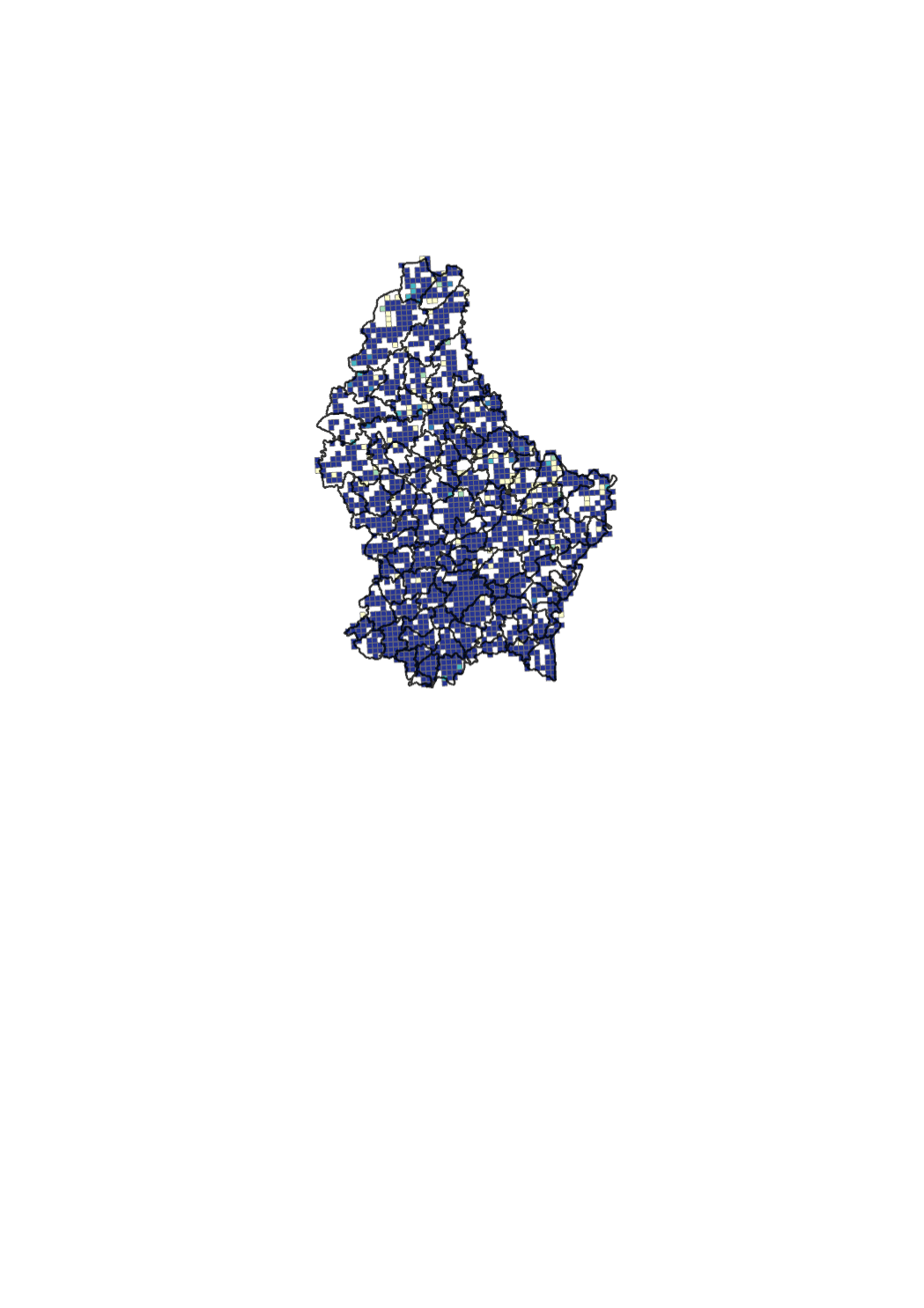
Broadband mapping for speeds between 30 Mbps and 100 Mbps
Ubiquitous access for citizens and companies to very high speed Internet is key for developing the national economy. Hence, the national strategy for very high-speed networks was elaborated in 2010 [ http://www.gouvernement.lu/3938123/2010-strategie-ultrahaut-debit.pdf]. The general objective of the strategy is to position the Grand-Duchy of Luxembourg among the leading broadband countries and to enable citizens, companies and public players to reap the associated socio-economic benefits. The strategy is in line with Europe 2020, a strategy for smart, sustainable and inclusive growth, as well as the Digital Agenda for Europe ( http://ec.europa.eu/digital-agenda). In the context of the Digital Agenda, the European Commission encourages broadband mapping exercises ( http://www.broadbandmapping.eu/). The broadband mapping indicates the percentage of households that can get fix access to very high-speed Internet, independent of the technology (copper cable, coax cable, optical fibre). The map is based on data provided on a voluntary basis by certain network providers and on estimations based on such data. Speeds are advertised speeds and may vary from actual speeds. <a href=' https://download.data.public.lu/resources/carte-de-la-couverture-internet-ultra-haut-debit/20180427-075634/couverture_DEC_2017.xlsx'>Link to the data</a> <a href='https://download.data.public.lu/resources/carte-de-la-couverture-internet-ultra-haut-debit/20180427-080236/2017_12_uhd_30MBit.pdf'>Link to the PDF map</a>
Simple
- Date (Creation)
- 2019-01-01T00:00:00
- Date (Revision)
- 2019-01-01T00:00:00
- Citation identifier
- / 5203f02c-1b44-4af4-be08-d35d19ef033a
- Presentation form
- Digital map
- Status
- On going
- Point of contact
-
Organisation name Individual name Electronic mail address Role Institut Luxembourgeois de Régulation
Elisabeth Weber
Point of contact
Point of contact
- Maintenance and update frequency
- As needed
-
Entités au Grand-Duché de Luxembourg
-
-
Grand-Duché du Luxembourg
-
- Keywords
-
- Keywords
-
-
Internet coverage
-
very high-speed
-
national strategy for very high-speed networks
-
Digital Agenda for Europe
-
Digital Lëtzebuerg
-
grid
-
geoportail.lu
-
-
geoportail.lu themes
-
-
Main
-
-
geoportail.lu structure
-
-
Main>Infrastructure and communication>Broadband internet
-
- Use constraints
- Other restrictions
- Other constraints
-
Creative Commons 1.0 Universal (CC0 1.0) Public Domain Dedication
- Spatial representation type
- Vector
- Denominator
- 0
- Language
- Lëtzebuergesch
- Language
- Deutsch
- Language
- Français
- Language
- English
- Character set
- UTF8
- Topic category
-
- Utilities communication
))
- Reference system identifier
- EPSG / http://www.opengis.net/def/crs/EPSG/0/2169
- OnLine resource
-
Protocol Linkage Name WWW:LINK-1.0-http--link
https://data.public.lu/fr/datasets/carte-de-la-couverture-internet-ultra-haut-debit/
- OnLine resource
-
Protocol Linkage Name https://map.geoportail.lu/theme/main?version=3&zoom=8&X=667917&Y=6394482&lang=fr&layers=671&opacities=1 Coverage ≥ 30 Mbit/s & < 100 Mbit/s
Metadata
- File identifier
- 5203f02c-1b44-4af4-be08-d35d19ef033a XML
- Metadata language
- Français
- Character set
- UTF8
- Hierarchy level
- Dataset
- Hierarchy level name
-
dataset
- Date stamp
- 2021-02-04T23:49:14
- Metadata standard name
-
ISO 19115:2003/19139
- Metadata standard version
-
1.0
- Metadata author
-
Organisation name Individual name Electronic mail address Role Institut Luxembourgeois de Régulation
Elisabeth Weber
Point of contact
- Other language
-
Language Character encoding French UTF8 Luxembourgish; Letzeburgesch UTF8 English UTF8 German UTF8
)))