 geocatalogue.geoportail.lu
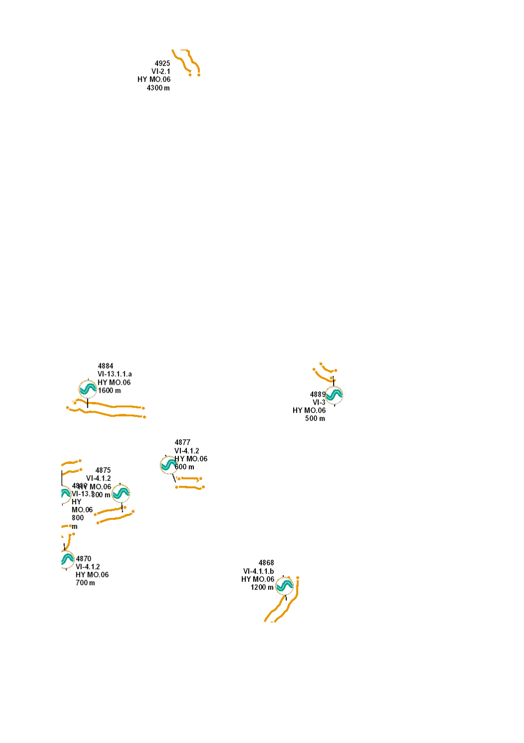
Establishment of riparian buffer strips
River protection against the impact of adjacent land use (agricultural runoff such as nutrients and pesticides, fine sediments, cattle trampling, erosion, etc.) through the establishment of fenced riparian buffer stripes, free from any use, where a typical riparian vegetation will grow and provide shade for the river.
Simple
- Citation identifier
- / 3bc0e52d-954b-47d3-8905-1ecfe7108ce0
- Presentation form
- Digital map
- Status
- Completed
- Point of contact
-
Organisation name Individual name Electronic mail address Role Administration de la gestion de l'eau
Division de l'hydrologie
Custodian
-
Entités au Grand-Duché de Luxembourg
-
-
Grand-Duché du Luxembourg
-
- Keywords
-
-
Water Framework Directive, WFD, hydromorphological measures, management plan, programme of measures 2021, HY MO, morphology, hydromorphologs, structure, river, riverbed, riverbank, buffer stripe
-
- Keywords
-
-
geoportail.lu
-
-
geoportail.lu themes
-
-
Water
-
Allgemeng
-
-
geoportail.lu structure
-
-
Water>Water framework directive [WFD]>River Basin Management Plan 2021
-
Grand Public>Environnement, biologie et géologie>Directive-cadre sur l'eau [DCE]>Plan de gestion 2021>Bewirtschaftungsplang 2021
-
- Access constraints
- Other restrictions
- Spatial representation type
- Vector
- Denominator
- 0
- Character set
- UTF8
))
- Maintenance and update frequency
- once
- Reference system identifier
- EPSG / http://www.opengis.net/def/crs/EPSG/0/2169
- OnLine resource
-
Protocol Linkage Name WWW:LINK-1.0-http--link
https://data.public.lu/fr/datasets/mise-en-place-de-bandes-rivulaires/ OGC API-Features
https://features.geoportail.lu/collections/2099 OGC API - Features
- OnLine resource
-
Protocol Linkage Name OGC:WMS-1.3.0-http-get-map
https://wms.geoportail.lu/public_map_layers/service 2099
https://map.geoportail.lu/theme/main?version=3&zoom=8&X=667917&Y=6394482&lang=fr&layers=2099&opacities=1 HY MO.06 2021 Establishment of riparian buffer strips
Metadata
- File identifier
- 3bc0e52d-954b-47d3-8905-1ecfe7108ce0 XML
- Metadata language
- Français
- Character set
- UTF8
- Hierarchy level
- Dataset
- Hierarchy level name
-
dataset
- Date stamp
- 2022-12-20T14:43:55Z
- Metadata standard name
-
ISO 19115:2003/19139
- Metadata standard version
-
1.0
- Metadata author
-
Organisation name Individual name Electronic mail address Role Administration de la gestion de l'eau
Administration de la gestion de l'eau
Point of contact
- Other language
-
Language Character encoding Luxembourgish; Letzeburgesch UTF8 English UTF8 German UTF8 French UTF8
)))