 geocatalogue.geoportail.lu
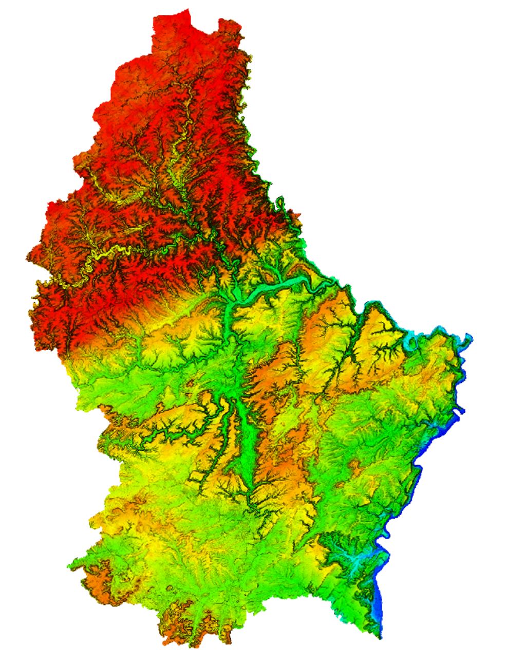
Digital Elevation Model - colored with hillshade 2019
In February 2019, the ACT has executed an airborne LiDAR survey for the whole country. One of the resulting products is a digital elevation model with a 50 cm resolution, combined with a hillshade.
Simple
- Citation identifier
- / 30577c48-b240-4f69-8431-e35ecaa85ebc
- Presentation form
- Digital map
- Status
- On going
- Point of contact
-
Organisation name Individual name Electronic mail address Role Administration du Cadastre et de la Topographie
Administration du Cadastre et de la Topographie
Point of contact
- Maintenance and update frequency
- As needed
-
Entités au Grand-Duché de Luxembourg
-
-
Grand-Duché du Luxembourg
-
- Keywords
-
-
LiDAR, Laser scan, digital elevation model, digital elevation model, DHM, DEM
-
- Keywords
-
-
geoportail.lu
-
- Keywords
-
-
intranet
-
-
geoportail.lu themes
-
-
Main
-
-
geoportail.lu structure
-
-
Main>Digital elevation model (BD-L-LiDAR)>LiDAR 2019
-
Main>Land surface>Digital elevation model (BD-L-LiDAR)>LiDAR 2019
-
- Spatial representation type
- Vector
- Denominator
- 0
- Character set
- UTF8
))
- Reference system identifier
- EPSG / http://www.opengis.net/def/crs/EPSG/0/2169
- OnLine resource
-
Protocol Linkage Name WWW:LINK-1.0-http--link
https://data.public.lu/fr/datasets/lidar-2019-modele-numerique-du-terrain/ OGC:WMS-1.3.0-http-get-map
https://wms.geoportail.lu/public_map_layers/service 1752
- OnLine resource
-
Protocol Linkage Name https://map.geoportail.lu/theme/main?version=3&zoom=8&X=667917&Y=6394482&lang=fr&layers=1752&opacities=1 Digital Height Model (detailed version)
Metadata
- File identifier
- 30577c48-b240-4f69-8431-e35ecaa85ebc XML
- Metadata language
- Français
- Character set
- UTF8
- Hierarchy level
- Dataset
- Hierarchy level name
-
dataset
- Date stamp
- 2025-03-25T09:53:59
- Metadata standard name
-
ISO 19115:2003/19139
- Metadata standard version
-
1.0
- Metadata author
-
Organisation name Individual name Electronic mail address Role Administration du Cadastre et de la Topographie
Administration du Cadastre et de la Topographie
Point of contact
- Other language
-
Language Character encoding Luxembourgish; Letzeburgesch UTF8 English UTF8 German UTF8 French UTF8

)))