 geocatalogue.geoportail.lu
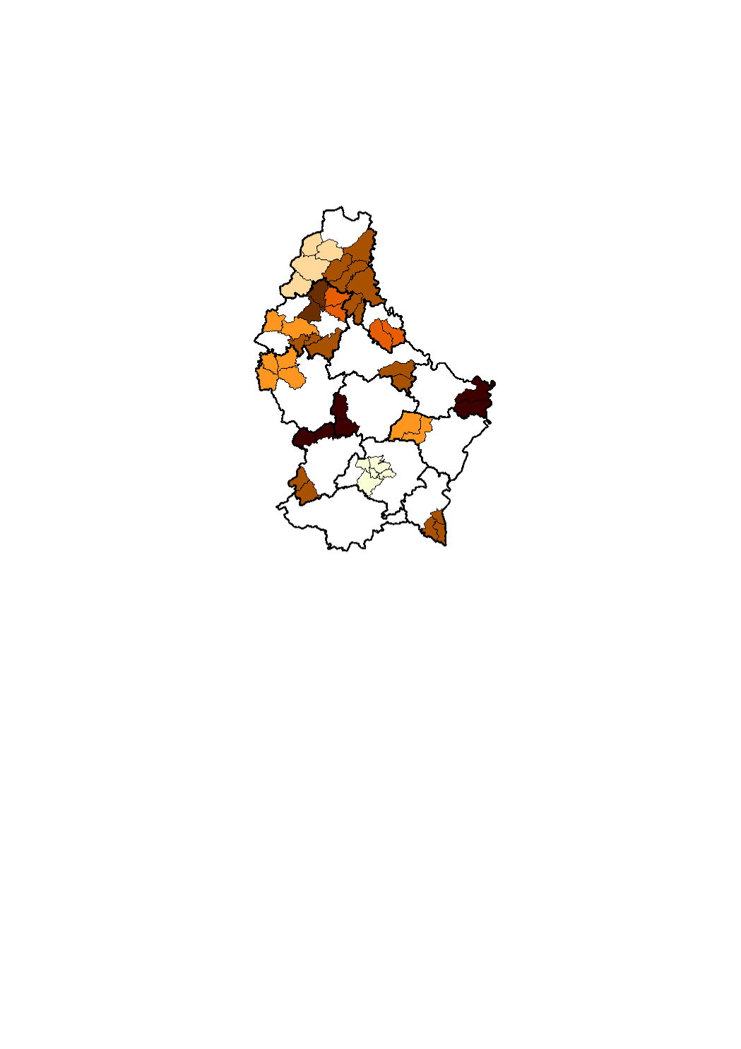
Overview of the fusions of the municipalities since 1920
Du point de vue administratif, la commune représente la plus petite subdivision territoriale du pays. Tout comme les cantons, les communes datent du découpage administratif mis en place lors de l'annexion du Luxembourg par les Français en 1795. Alors que le nombre et la configuration des cantons sont restés inchangés depuis leur création, les communes ont connu de nombreuses modifications. Au fil du temps, les communes ont vu changer leur nombre par des scissions et des fusions. La carte montre l'historique des fusions communales depuis 1920. Lors des 17 fusions, 45 communes ont été regroupées dans de nouvelles subdivisions administratives.
Simple
- Citation identifier
- / 07ce11d6-1cc7-4e87-9d09-ceb89c39bfe1
- Presentation form
- Digital map
- Status
- On going
- Point of contact
-
Organisation name Individual name Electronic mail address Role STATEC - Population et logement
Charlie Klein
Point of contact
- Maintenance and update frequency
- As needed
-
Entités au Grand-Duché de Luxembourg
-
-
Grand-Duché du Luxembourg
-
- Keywords
-
- Keywords
-
-
municipality
-
fusions
-
geoportail.lu
-
-
geoportail.lu themes
-
-
Demographic atlas of Luxembourg
-
-
geoportail.lu structure
-
-
Demographic atlas of Luxembourg>Territorial organisation>Territoiral organisation of Luxembourg
-
- Use constraints
- Other restrictions
- Other constraints
-
Creative Commons 1.0 Universal (CC0 1.0) Public Domain Dedication
- Spatial representation type
- Vector
- Denominator
- 0
- Character set
- UTF8
))
- Reference system identifier
- EPSG / http://www.opengis.net/def/crs/EPSG/0/2169
- OnLine resource
-
Protocol Linkage Name OGC:WMS-1.3.0-http-get-map
https://wms.geoportail.lu/public_map_layers/service 1531
WWW:LINK-1.0-http--link
https://data.public.lu/fr/datasets/limites-communales-historiques-1/ OGC API-Features
https://features.geoportail.lu/collections/1531/9 OGC API - Features
OGC API-Features
https://features.geoportail.lu/collections/1531/10 OGC API - Features
OGC API-Features
https://features.geoportail.lu/collections/1531/11 OGC API - Features
OGC API-Features
https://features.geoportail.lu/collections/1531/12 OGC API - Features
OGC API-Features
https://features.geoportail.lu/collections/1531/13 OGC API - Features
OGC API-Features
https://features.geoportail.lu/collections/1531/14 OGC API - Features
OGC API-Features
https://features.geoportail.lu/collections/1531/15 OGC API - Features
- OnLine resource
-
Protocol Linkage Name https://map.geoportail.lu/theme/main?version=3&zoom=8&X=667917&Y=6394482&lang=fr&layers=1531&opacities=1 Overview of the fusions of the municipalities since 1920
Metadata
- File identifier
- 07ce11d6-1cc7-4e87-9d09-ceb89c39bfe1 XML
- Metadata language
- Français
- Character set
- UTF8
- Hierarchy level
- Dataset
- Hierarchy level name
-
dataset
- Date stamp
- 2026-04-20T08:46:50.258915Z
- Metadata standard name
-
ISO 19115:2003/19139
- Metadata standard version
-
1.0
- Metadata author
-
Organisation name Individual name Electronic mail address Role STATEC - Population et logement
Charlie Klein
Point of contact
- Other language
-
Language Character encoding Luxembourgish; Letzeburgesch UTF8 English UTF8 German UTF8 French UTF8
)))