 geocatalogue.geoportail.lu
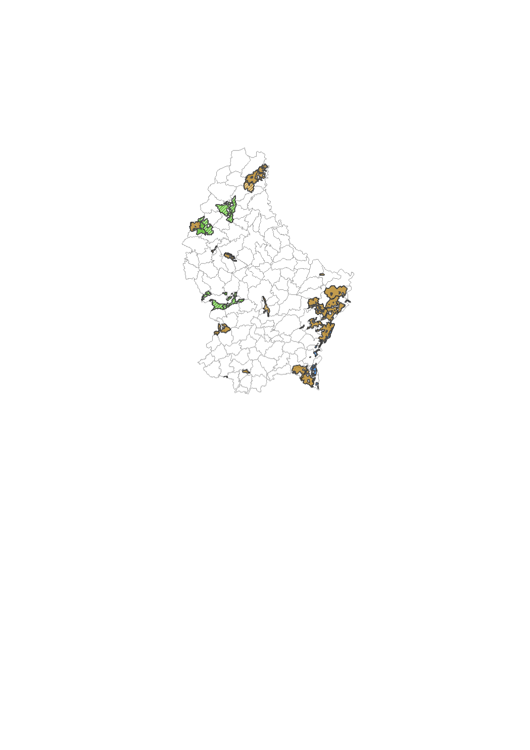
Land consolidation zones
Zones defining where land consolidation has been done according to the law of 1964. This is useful in order to find out whether a parcel is concerned by the given law or not.
Simple
- Citation identifier
- / 03d079f3-61fb-48bc-ab39-f3427b208702
- Presentation form
- Digital map
- Status
- On going
- Maintenance and update frequency
- As needed
-
Entités au Grand-Duché de Luxembourg
-
-
Grand-Duché du Luxembourg
-
- Keywords
-
-
land consolidation
-
- Keywords
-
-
geoportail.lu
-
-
geoportail.lu themes
-
-
Urban Farming
-
Main
-
-
geoportail.lu structure
-
-
Urban Farming>Cadastral data
-
Main>Geographical location>Cadastral data
-
- Use limitation
-
This data must not be overlayed with any other data than the cadastral plan.
- Access constraints
- Other restrictions
- Other constraints
-
-
- Spatial representation type
- Vector
- Denominator
- 500
- Language
- Français
- Character set
- UTF8
- Topic category
-
- Environment
- Farming
- Planning cadastre
))
- Reference system identifier
- EPSG / http://www.opengis.net/def/crs/EPSG/0/2169
- OnLine resource
-
Protocol Linkage Name OGC API-Features
https://features.geoportail.lu/collections/417 OGC API - Features
- OnLine resource
-
Protocol Linkage Name OGC:WMS-1.3.0-http-get-map
https://wms.geoportail.lu/public_map_layers/service 417
https://map.geoportail.lu/theme/main?version=3&zoom=8&X=667917&Y=6394482&lang=fr&layers=417&opacities=1 Land consolidation zones
- Statement
-
Administration du Cadastre et de la Topographie
Metadata
- File identifier
- 03d079f3-61fb-48bc-ab39-f3427b208702 XML
- Metadata language
- Français
- Character set
- UTF8
- Hierarchy level
- Dataset
- Hierarchy level name
-
dataset
- Date stamp
- 2021-02-04T23:19:07Z
- Metadata standard name
-
ISO 19115:2003/19139
- Metadata standard version
-
1.0
- Metadata author
-
Organisation name Individual name Electronic mail address Role Administration du Cadastre et de la Topographie
Paul Mootz
Point of contact
- Other language
-
Language Character encoding Luxembourgish; Letzeburgesch UTF8 English UTF8 German UTF8 French UTF8
)))