 geocatalogue.geoportail.lu
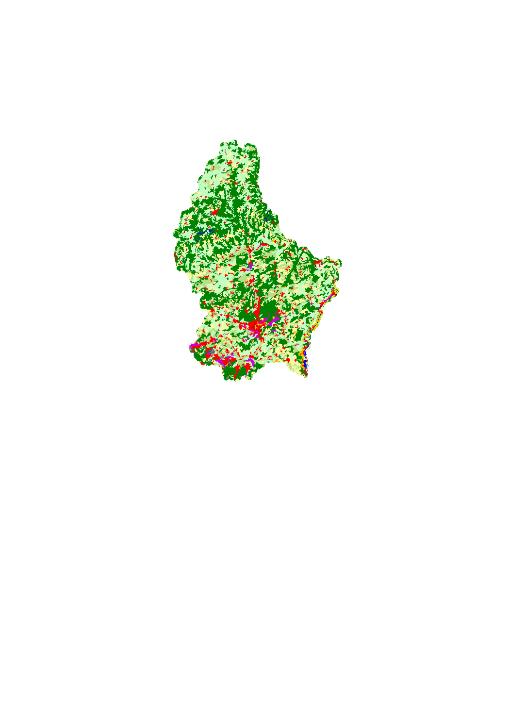
Corine Landcover
Corine Land Cover est une base de données européenne d'occupation biophysique des sols. Ce projet est piloté par l'Agence européenne de l'environnement et couvre 38 Etats. La partie luxembourgeoise est réalisée par le Département de l'Environnement du Ministère du Développement durable et des Infrastructures. Cette base est l'une des composantes du projet européen GMES5 et fait partie du champ de la directive européenne INSPIRE. Trois versions ont été produites : 1990, 2000 et 2006
Simple
- Date (Creation)
- 2006-12-11T00:00:00
- Date (Revision)
- 2006-12-17T00:00:00
- Citation identifier
- / 0098c72d-490e-4b03-91f6-f844502883a0
- Presentation form
- Digital map
- Status
- On going
- Point of contact
-
Organisation name Individual name Electronic mail address Role Ministère du Développement durable et des Infrastructures - Département de l'Environnement
Grivet Patrick
Point of contact
Point of contact
- Maintenance and update frequency
- As needed
-
Entités au Grand-Duché de Luxembourg
-
-
Grand-Duché du Luxembourg
-
- Keywords
-
- Keywords
-
-
Corine Landcover
-
Landcover
-
Occupation
-
sol
-
geoportail.lu
-
-
geoportail.lu themes
-
-
Environment
-
Main
-
-
geoportail.lu structure
-
-
Environment>Land use
-
Main>Land surface>Land use
-
- Use constraints
- Other restrictions
- Other constraints
-
Creative Commons 1.0 Universal (CC0 1.0) Public Domain Dedication
- Spatial representation type
- Vector
- Denominator
- 100000
- Language
- Français
- Character set
- UTF8
- Topic category
-
- Environment
))
- Reference system identifier
- EPSG / http://www.opengis.net/def/crs/EPSG/0/2169
- OnLine resource
-
Protocol Linkage Name OGC:WMS-1.3.0-http-get-map
https://wms.geoportail.lu/public_map_layers/service 167
WWW:LINK-1.0-http--link
https://data.public.lu/fr/datasets/corine-landcover-2006/
- OnLine resource
-
Protocol Linkage Name https://map.geoportail.lu/theme/main?version=3&zoom=8&X=667917&Y=6394482&lang=fr&layers=167&opacities=1 Corine Landcover 2006
Metadata
- File identifier
- 0098c72d-490e-4b03-91f6-f844502883a0 XML
- Metadata language
- Français
- Character set
- UTF8
- Hierarchy level
- Dataset
- Hierarchy level name
-
dataset
- Date stamp
- 2021-02-04T22:42:00
- Metadata standard name
-
ISO 19115:2003/19139
- Metadata standard version
-
1.0
- Metadata author
-
Organisation name Individual name Electronic mail address Role Ministère du Développement durable et des Infrastructures - Département de l'Environnement
Grivet Patrick
Point of contact
- Other language
-
Language Character encoding French UTF8 Luxembourgish; Letzeburgesch UTF8 English UTF8 German UTF8
)))